
POINT MARIAH
This hike offers expansive views of the Granite Chief Wilderness, the Pacific Crest Trail between Sugar Bowl and Squaw Valley, and the breathtaking Royal Gorge of the North Fork of the American River (one of the deepest canyons in the western US).
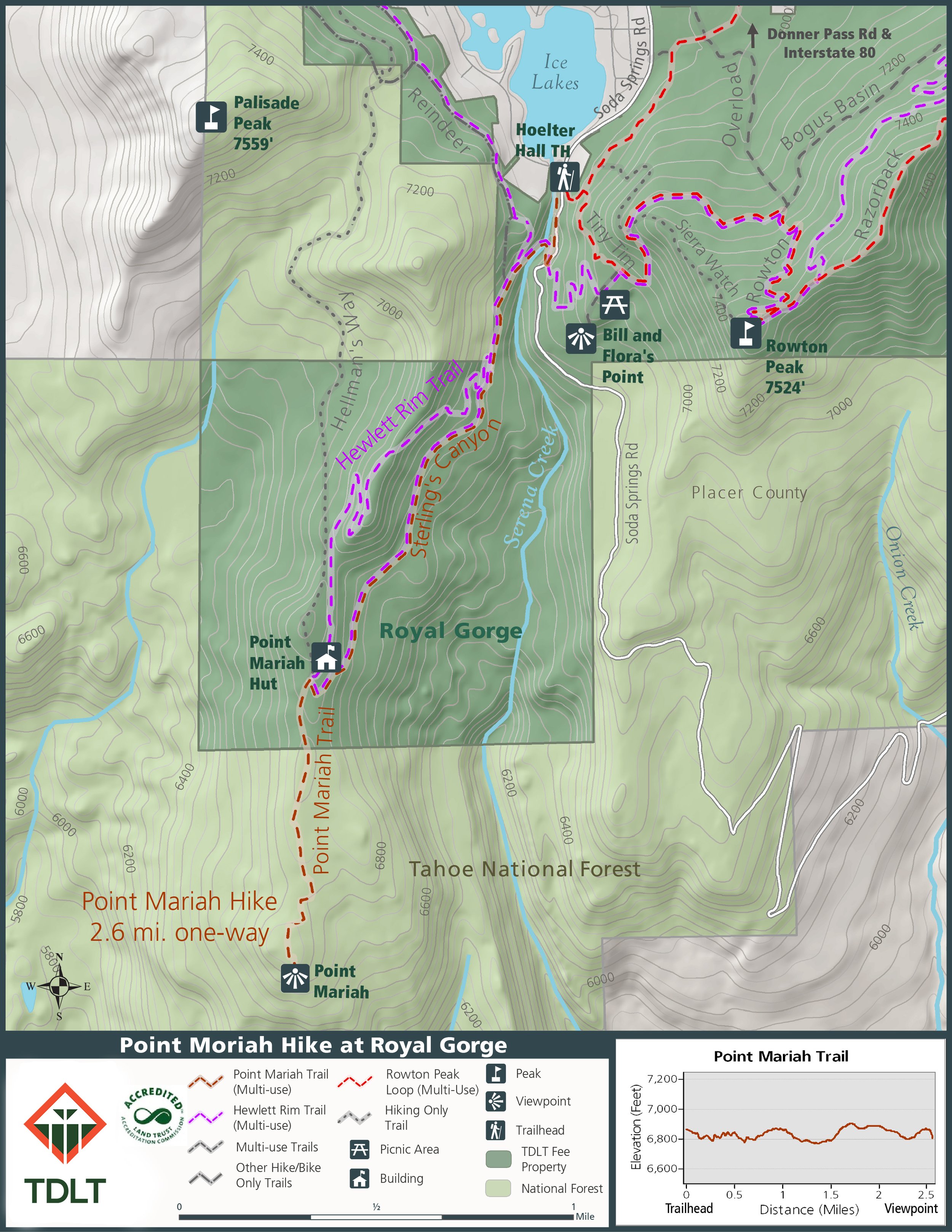
Park at the Hoelter Hall Trailhead. For directions to the trailhead, see the HOW TO GET THERE on the Royal Gorge Overview page.
From the trailhead, hike straight past the kiosk between the rocks at the end of the parking area and go downhill. In just 75 feet, take the trail that branches 90 degrees to the left and goes uphill. This trail is the unsigned Tiny Tim Ski Trail. In about 100 yards up the hill, you will see a Tiny Tim sign at an intersection. Continue uphill on Tiny Tim trail and at about 0.2 mi from the parking area, a smaller trail, Little Dip, branches to the right. Turn right onto Little Dip and descend fairly steeply downhill for about 0.2 mi to a large dirt road, Soda Springs Road. Turn right on Soda Springs Road and follow it for 0.1 mi to a trail that descends to a bridge. Take this trail and cross the bridge.
Once across the bridge, you will be on Sterling's Canyon trail. It is a rolling trail that continues south ascending slowly above the creek. Follow this wide trail, ignoring trails branching to the right. At about 1.0 mi from the trailhead, you will see a metal sign indicating Point Mariah 1.86 mi ahead (it also indicates an alternate 2.56 mi route to Point Mariah branching to the right as an alternative). Continue straight past the sign and stay on the wide Sterling’s Canyon trail. In a little over 1.2 mi from the trailhead is a flat area on the left that provides a beautiful overlook of Serena Canyon and the upper basin of the North Fork of the American River.
At 1.6 mi from the trailhead is a trail intersection with another Royal Gorge cross-country ski sign. The Sterling’s Canyon trail turns right up a short, relatively steep hill. Go straight at this intersection, leaving Sterling’s Canyon trail, and follow the sign for Whitney’s Bowl and Pt Mariah.
In about 2.0 mi from the parking area, one of the Royal Gorge cross-country warming huts will be slightly uphill on your right - It is difficult to see because it is only visible on your right after you pass it. As you go past the warming hut, the trail continues uphill and in about 100 yards, you are at the top of the ridge. A trail comes in from the right but continue straight ahead on the unsigned but obvious trail; this is the Pt. Mariah Trail. Follow this trail for about .75 mi to Pt. Mariah. Along the way, be sure to look to your right for beautiful views of Devil’s Peak and to its left, Snow Mountain, another property conserved by TDLT. When you get to Pt. Mariah, take time to enjoy the fabulous views down into the Royal Gorge of the North Fork of the American River and the surrounding wilderness.
After a short rest, and perhaps a snack or lunch, you are ready for the return trip. Retrace your steps to the trailhead and you have completed one of Royal Gorge's iconic hikes.